by Daniel | Last Updated January 10th, 2022

You might think of Los Angeles as a bustling highway of overpasses, but it actually has an abundance of natural elements.
It is home to the largest city-dwelling preservation area and a large variety of flora and wildlife to explore. Plus, the dominance of sunny, warm days makes it perfect for enjoying the great outdoors.
So, if you are seeking an escape from the nearly 4 million residents of Los Angeles, it is quite easy to find a tranquil trail. Some offer views of the city while other destinations lead you into the distant mountain ranges.
Read on to discover the most exciting LA hikes in and around the city.
Bridge to Nowhere
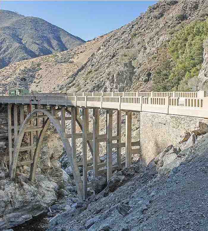
If you are looking for an adventure then the Bridge to Nowhere is one of the best hikes in Los Angeles. It isn’t an easy task as it involves 6 hours of traversing through rough, rocky terrain and crossing at least 4 rivers in ankle- to knee-deep water.
It does have its rewards of crossing a historic and dramatic bridge that once served as a connecting road over the San Gabriel River.
Built in 1936, it bridged the gap between the south of San Gabriel and the north of Wrightwood. Unfortunately, the bridge was put to use for only two years after a flood destroyed the road leading to it.
It is now an isolated site-seeing destination for enthusiastic hikers.
Some tips to remember on this hike include bringing extra shoes for after crossing several rivers and a lot of water since most of the hike is not shaded.
Be sure to carry a reliable and possibly waterproof backpack for gear and snacks.
Cave Muntis
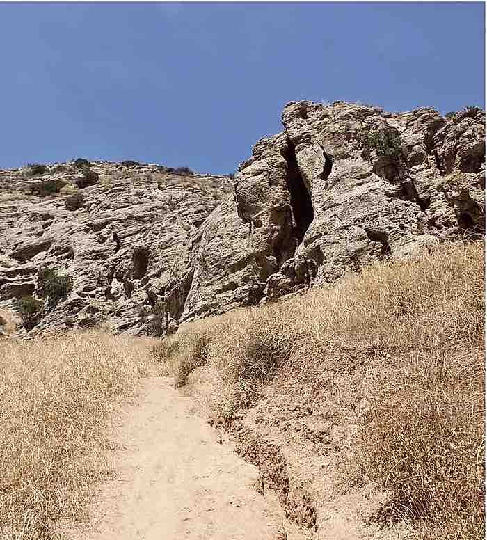
This short Los Angeles hiking trail might only be a 2.1-mile loop but it passes through two parks with plenty to see. Its highlight though is the vertical cave on your way up to Castle Peak.
The beginning of the hike starts on El Escorpion Trail off of San Fernando Valley where you will get a stunning glimpse of Castle peak before ascending upon it.
It is a steep climb up to the peak rising 750 feet. But, the cave is only .8 miles where you can rest and explore the canyon.
The cave is easy to climb into without ropes or climbing gear as it has some good footing and grooves for grabbing. Once you enter, you will notice its high ceilings and narrow width of only 15 feet.
Often missed is the deepest part of the cave where it gets dark so you might need a flashlight. The rest of the cave has natural skylights, letting in spots of light.
The sunlight and the orange rock produce a serene atmosphere that attracts hikers to this special spot.
You can return back the way you came as you gaze upon the scenic view of the surrounding rock formations. This option is an easy round trip of 1.9 miles.
Or you can continue up Castle Peak, which is the steepest part of the hike even though it is short. If you choose this option, take the other exit out of the cave by way of the small window-size hole on the left at about 25-feet high.
Once out of the cave, climb over the top of it and peek through the holes in the cave below.
Continue on the dirt path with a 450-feet incline to the peak in just .2 miles. Take in the 360-degree view and take a deep, well-deserved breath.
Eagle Rock and Temescal Peak
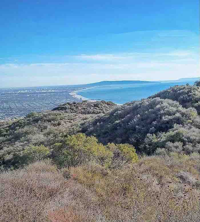
This hike is located in Topanga State Park, the largest state park in the Santa Monica Mountains and in Los Angeles proper. Despite its accessibility and popularity, its size makes this hike quiet and isolated.
And since it is part of a state park, the Eagle Rock and Temescal Peak are easy to find with proper signs and trials.
Along the 7-mile loop, you will encounter a robust display of flowering meadows. You will also get a peek of the Pacific Ocean, the Los Padres Mountains, the Santa Monica Mountain Range, and even the distant views of Los Angeles.
Eagle Rock is just 2 miles from the Trippet Ranch Trailhead. You will notice the dramatic protruding bolder in the distance after only 1 mile of hiking.
Climb the rock for breathtaking views as you rest on a dedicated bench on top of the boulder.
Continue on the main fire road until you come to a junction leading you to Rogers Road Trail that will take you to a side trail. In a short while, you will reach Temescal Peak.
Soak in the final views of the city on the horizon and the distance Eagle Rock before heading back and catching lunch at one of LA’s best restaurants.
Switzer Falls and Bear Canyon
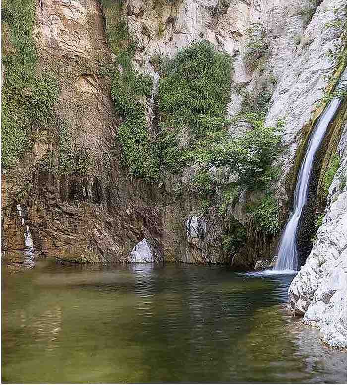
It may be surprising that some Los Angeles hikes do include impressive waterfalls considering its long dry seasons.
Part of Angeles National Forest, Switzer falls is one of the most sought-after site-seeing hikes. Luckily, it has many hidden secluded water holes to escape the crowd.
Starting the hike is simple since you can park at the picnic area. The trails begin with pavement and slowly transform into a fun rigid path going over boulders and into the canyon.
Be careful of recent rainstorms that may flood the adjacent river and fill up the canyon.
You will also notice the scorched terrain from a serious station fire in 2009. Many of the trees were burned, but the foliage is slowly reviving itself.
The hike takes you high into the ridge of the canyon for panoramic views then back down to view the bottom of the falls. One short trail leads to the waterfall while the other continues in Bear Canyon.
If you only want to see the falls, then your round trip is about four miles. But, if you want to find those soothing swimming holes you will have to hike a little further into the canyon.
Venturing about 3 miles into the canyon, you may discover Bear Canyon Campground. It is secluded but still functional for an overnight stay in the canyon.
Griffith Park
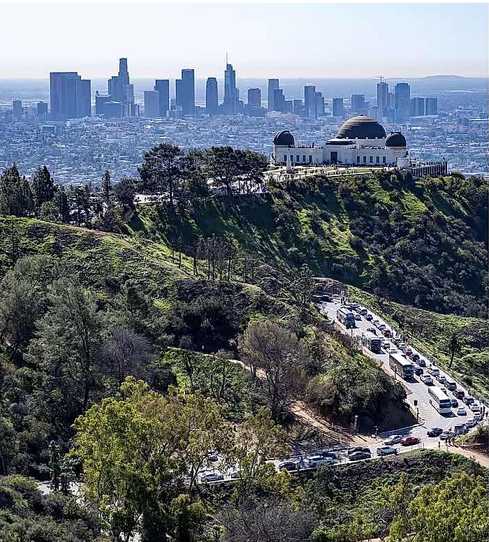
Hiking in Los Angeles has to include Griffith Park as it is the 10th biggest local park in the U.S. with 43,000 acres and over 53 miles of hiking trails. If you want the grandeur of a National Park, Griffith is for you.
While the park is a bit more conventional than some of the off-the-grid hikes, it still offers an abundance of wildlife and spectacular views. You just might have to go the distance to avoid bumping into other tourists.
This park is perfect for adventurous children with an array of family-friendly recreational activities including swimming, horseback riding, and bicycling.
Kids can camp at the boy’s and girl’s campsites. They can also take the popular hike to the Mount Hollywood summit to get the best views of the city down below.
Take another trail to a 5-year-old abandoned zoo that still has its cages left untouched.
While much of the park is filled with attractions like the Griffith Observatory and the Los Angeles Zoo & Botanical Gardens, there is still land left to explore.
Echo Mountain
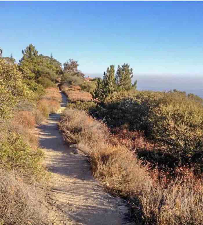
Travel back to a time of western exploration only the spontaneous and well-off could enjoy.
Echo Mountain was home to a luxury resort back in the 1890s called White City. Built by Thaddeus Lowe, a renaissance man of many talents, the resort sat some 3,200 feet overlooking the city of Pasadena.
As an inventor, Lowe was able to work with a local engineer to construct the Mount Lowe Railway to allow guests to sightsee without breaking a sweat. The transport eventually took over 3 million guests to his resort.
Today, the resort and the railway serve as a ruin as it was destroyed in 1936 by a fire.
During your hike, you will walk along the path of the railway escalating over 1,400 feet.
On the way, you get wonderful views of the Las Flores and Rubio Canyons. Once you reach the peak, you will notice remnants of the resort and even a left-over rail trolley.
You will also see why the mountain is called Echo because of its echo phones. Metal circular structures were used prior to the installation of telephones.
People could call out through the structure and blast their messages across the canyon.
What once was an exclusive resort for California’s rich and famous, is now a free spot for hikers to explore.
Trans-Catalina Trail Loop
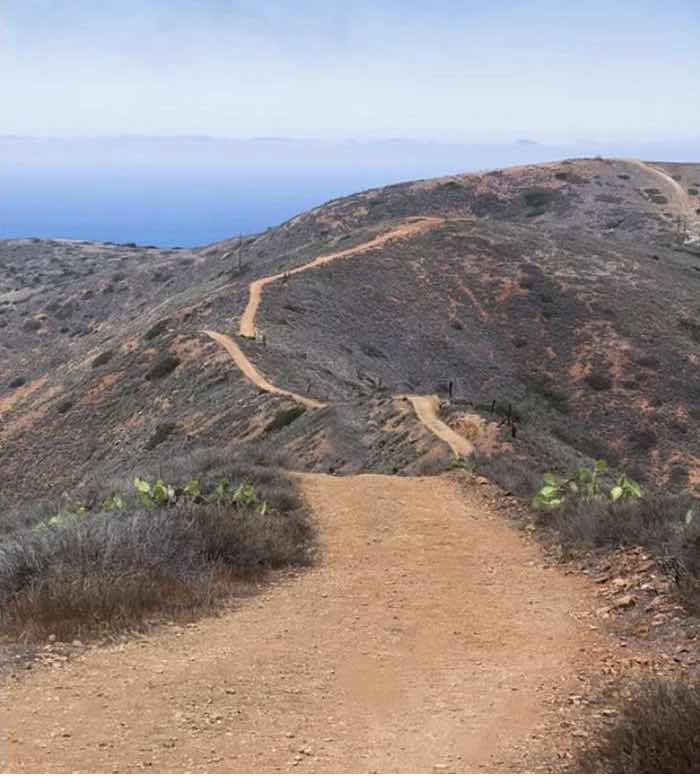
Some of the best hiking trails in LA aren’t physically in Los Angeles. If you really want to get away from city life for a day or two take a ferry to Catalina Island to the city of Avalon.
While it is a 22-mile ferry ride, the island still resides in Los Angeles County. Avalon serves as a resort community especially for tourists with an abundance of hotels and restaurants.v
But, for the outdoor enthusiasts, it has an 11.75-mile hike that showcases the breathtaking views of the Pacific Ocean. You can also stay at the Hermit Gulch Campground instead of one of the city’s beach resorts. v
Departing from the campground, you will slowly climb to 1,600 feet then descend back to the seashore. You can walk to downtown Avalon passing Lover’s Cove on the way.
To hike the trail you will need to obtain a free permit from the Catalina Island Conservatory.
Franklin Canyon Park
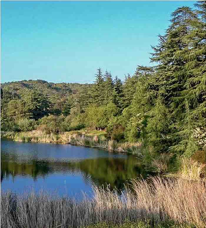
Best in the summer months, this park is famous for its Upper Franklin Canyon Reservoir made in 1914.
You might recognize the lake from Hollywood scenes like The Andy Griffith Show, movies like Creature from the Black Lagoon, and on album covers like Sounds of Silence by Simon and Garfunkel.
The park includes 605 acres of space and 5 miles of various hiking trails. Along the way, you will see a nature center, an outdoor amphitheater, and an auditorium.
You will also notice an abundance of wildlife congregating around the 3-acre lake including ducks and other seasonal birds.
The longest trail, Hastain Trail, is 2.3 miles and leads you up to the top of the canyon. You will get views of the canyon below as well as the ocean on a clear day.
Eaton Canyon
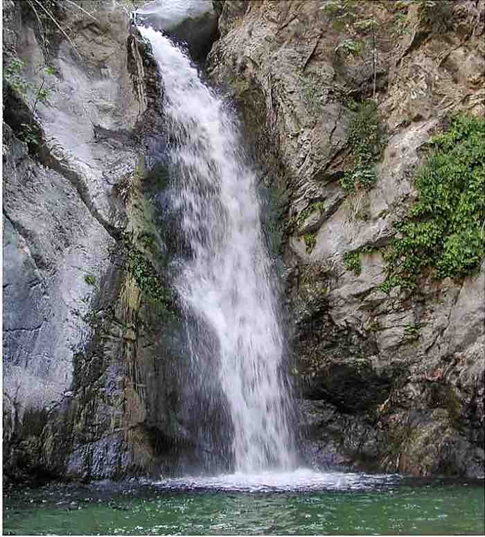
Located among the San Gabriel Mountains this 190-acre nature preserve is a must-see destination. It includes a 4-foot waterfall that serves as a natural air conditioner in the warmer months.
During the rainy season, you might have to cross some streams when they get flooded so bring an extra pair of shoes and socks. You also want shoes with a good grip as the trail gets a little rough. There are several boulders to climb.
Visit the nature center for an up-close encounter of native wildlife that you miss on your hike.
Parker Mesa Overlook
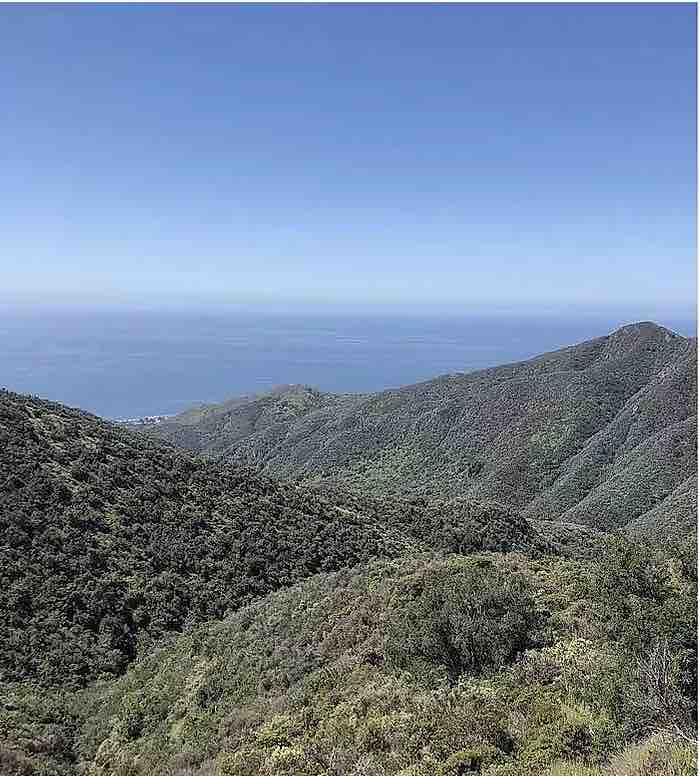
On the west side of the Topanga State Park off the East Topanga Fire Road is the Parker Mesa Overlook. Here is where you can watch sunsets on Santa Monica Bay and the Pacific Ocean.
The visible shoreline goes from Palos Verdes to Malibu, giving you an extensive view of most of LA’s coast.
There are several options to reach the overlook depending on your desired level of difficulty. The longest hike in this state park is about 7.8 miles with an incline of 1,300. The easiest is the 5.7-mile hike with a 900-foot elevation.
You will get plenty of sunshine as the trail consists of mostly shrubs and grass so bring sunscreen.
Los Angeles Hikes for Tourists
If you are from out of town and want to find some of the best hikes in Los Angeles to enjoy then you should plan ahead. Use this guide to decide which parks and trails you would like to visit. You can get maps and reserve campgrounds before your visit.
